Digitisation of cable plans
SCS wins an international ideas competition and supports Danish railways in the digitisation of cable plans. The information density of the cable plans is enormous: a manual digitisation would take several years. SCS's concept is to automate these manual steps to a large extent. Among other things, learning systems are to be used for automation.

-

Problem
Banedanmark needs to digitise more than 10,000 cable plans. The information must be easily and quickly accessible and is especially important for construction work so that no "forgotten" cables are torn out.
-

Solution SCS
With a self-learning system from semi-automatic to fully automated - This was the credo of the SCS concept. Through close collaboration between man and machine, more and more work can be automated step by step.
-

How to continue
SCS's ideas have expanded the technological solution space for Danish Railways and are now flowing into concrete project implementation - a success for AI systems in the rail sector
Project insights
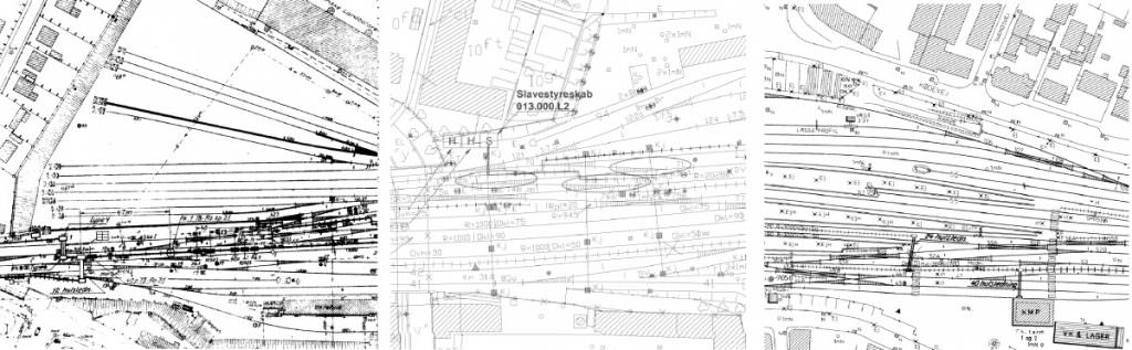
Banedanmark's cable plans differ in age, quality and scale (Figure 1). The information density of the cable plans is enormous: a manual digitisation would take several years. The SCS concept is to automate these manual steps to a large extent. Among other things, learning systems are to be used for automation. AI-based systems need a lot of labelled data through which the algorithms can be trained. Only with a solid "ground truth" can learning be reliable. The SCS concept optimises the creation of a reliable ground truth, among other things.
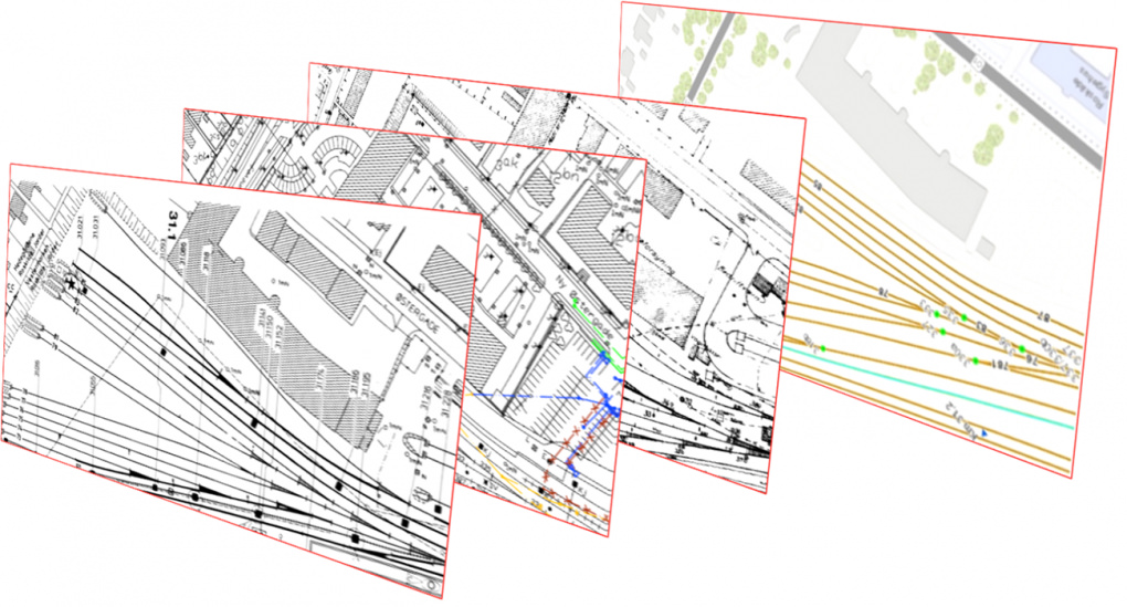
Several cable plans from the last decades are available for the individual locations. The plans are first located and superimposed (Figure 2). Different plans of the same site often contain complementary information, which represents a great opportunity because it can be used to massively optimise the creation of a ground truth. Like the rosetta stone, it can help to recognise unknown information in one plan by already known information in another. This can massively optimise the creation of a ground truth.
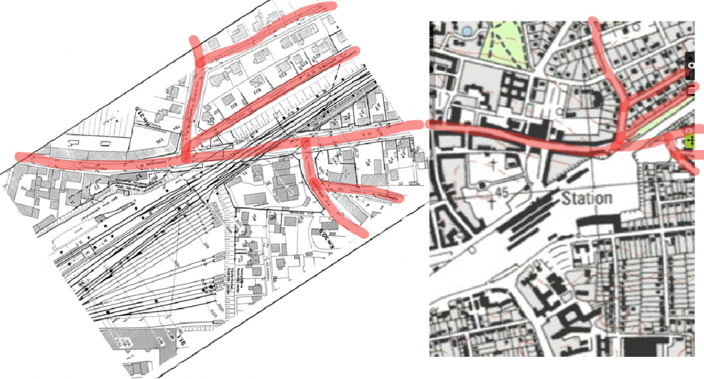
The localisation is done in two steps. In the first step, the map is roughly located and the station or railway line is determined, for example, by character recognition. In the second step, the plan is finely located. The fine localisation is done by correlating e.g. streets (Figure 3) of the plan with a map.